It’s just after sunrise at Black Balsam Knob. The air bites your cheeks, your coffee is steaming on the car roof, and a sea of ridges below you is turning red, gold and rust in slow motion. Twenty minutes later, the parking area is full. That’s the Blue Ridge Parkway in fall in a nutshell: stunning, and very popular.
The good news is you don’t need luck to catch it. You need to understand one thing (the color moves downhill) and pick the right stretch for the week you’re there. Here are the best overlooks, the stops worth stepping out for, and three drives you can fit into a single day.
Building a bigger trip around it? Browse our United States travel guides and tours for ideas beyond the mountains.
- Best time: most of October; high elevations turn first, valleys last
- Length: 469 miles, from Rockfish Gap in Virginia to Cherokee in North Carolina
- Entrance fee: none, it’s free to drive
- Speed limit: 45 mph at most, lower in busy spots
- Time needed: one day for a highlight section, four or five days for the whole road
- Best bases: Asheville, Blowing Rock or Boone, and Roanoke
When the Blue Ridge Parkway turns color (hint: it rolls downhill)
The Parkway climbs from about 650 feet at the James River in Virginia to over 6,000 feet near Richland Balsam in North Carolina. That spread is the whole secret. Leaves turn at the top first, then the color slides down the mountains over roughly a month.
- Above 5,000 feet: first patches in late September, strong by early October
- 4,000 to 5,000 feet: mid-October, which covers most of the famous overlooks
- Below 3,000 feet: late October into early November, including the valleys around Asheville and Roanoke
Two spots reliably light up first: Graveyard Fields (milepost 418.8) and Rough Ridge (milepost 302.8), where low shrubs flush deep red before the forests around them catch up. If you can only pick one week, mid-October puts the most overlooks near their best.
Weather decides the rest. Sunny days, cool nights that stay above freezing and decent rainfall make the richest reds. A warm, soggy or bone-dry autumn mutes the show, so check the Blue Ridge Parkway Foundation’s fall color guide and webcams the week before you go.
Chasing leaves is addictive. If you catch the bug, the same follow-the-color logic works on the other side of the world in our guide to Kyoto’s autumn leaves and how to dodge the crowds.
Getting there and around (at 45 mph, on purpose)
You’ll need a car. There’s no public transport along the Parkway, and commercial vehicles aren’t allowed on it. The handiest airports sit near the main bases: Asheville for the North Carolina highlights and Roanoke for Virginia.
The speed limit tops out at 45 mph and drops to 35 in congested spots like Mabry Mill. No stoplights, no billboards, plenty of curves. You’ll cover far fewer miles per day than you expect, mostly because you’ll pull over every ten minutes.
Navigation is old-school. The road is marked with mileposts, from 0 at Rockfish Gap to 469 at Cherokee, and every stop in this guide uses them. Cell signal disappears for long stretches, so download offline maps before you leave town. Fill the tank there too, because fuel means detouring off the Parkway down winding exit roads.
Sections can close for storm damage, rockslides or repairs, sometimes for months. Check the official NPS road status page the morning you drive, not the week before.
Renting a car? Sort out cover before you reach the counter. Our breakdown of which rental insurance extras are worth paying for is written for Iceland, but the logic travels well.
Best overlooks in Virginia (the calmer end)
The Virginia section sees a fraction of the North Carolina crowds, and many of its lower overlooks hold color later. Think farm valleys, split-rail fences and long views west over the Shenandoah Valley.
Humpback Rocks (milepost 6)
A short, steep trail climbs to a rocky hump with a wide-open view. Near the parking area, an old mountain farm shows how Appalachian families lived without electricity or plumbing. Go early; locals love this one.
Ravens Roost (milepost 10.7)
About 3,200 feet up and facing west, this is one of the best sunset spots on the whole road. A low stone wall lines the edge, the valley rolls out below, and the rock ledge next door belongs to climbers and, yes, ravens.
Peaks of Otter (milepost 86)
A lake, a lodge and three peaks wrapped around a valley. The climb up Sharp Top is a leg-burner, but the summit view has been pulling visitors up since Thomas Jefferson’s day. On calm mornings, the lake mirrors the whole hillside of color.
Mabry Mill (milepost 176.1)
A weathered wooden gristmill beside a pond, framed by red maples. It’s one of the most photographed spots on the Parkway, and a short trail loops past the mill, a sawmill and a blacksmith shop.
The High Country: Rough Ridge to Grandfather Mountain
Near Blowing Rock and Boone, the road wraps around Grandfather Mountain and the scenery gets dramatic fast. This short stretch packs more jaw-drop per mile than almost anywhere else on the route.
- Price Lake (milepost 296.7): flat, easy walking and mirror reflections on still mornings.
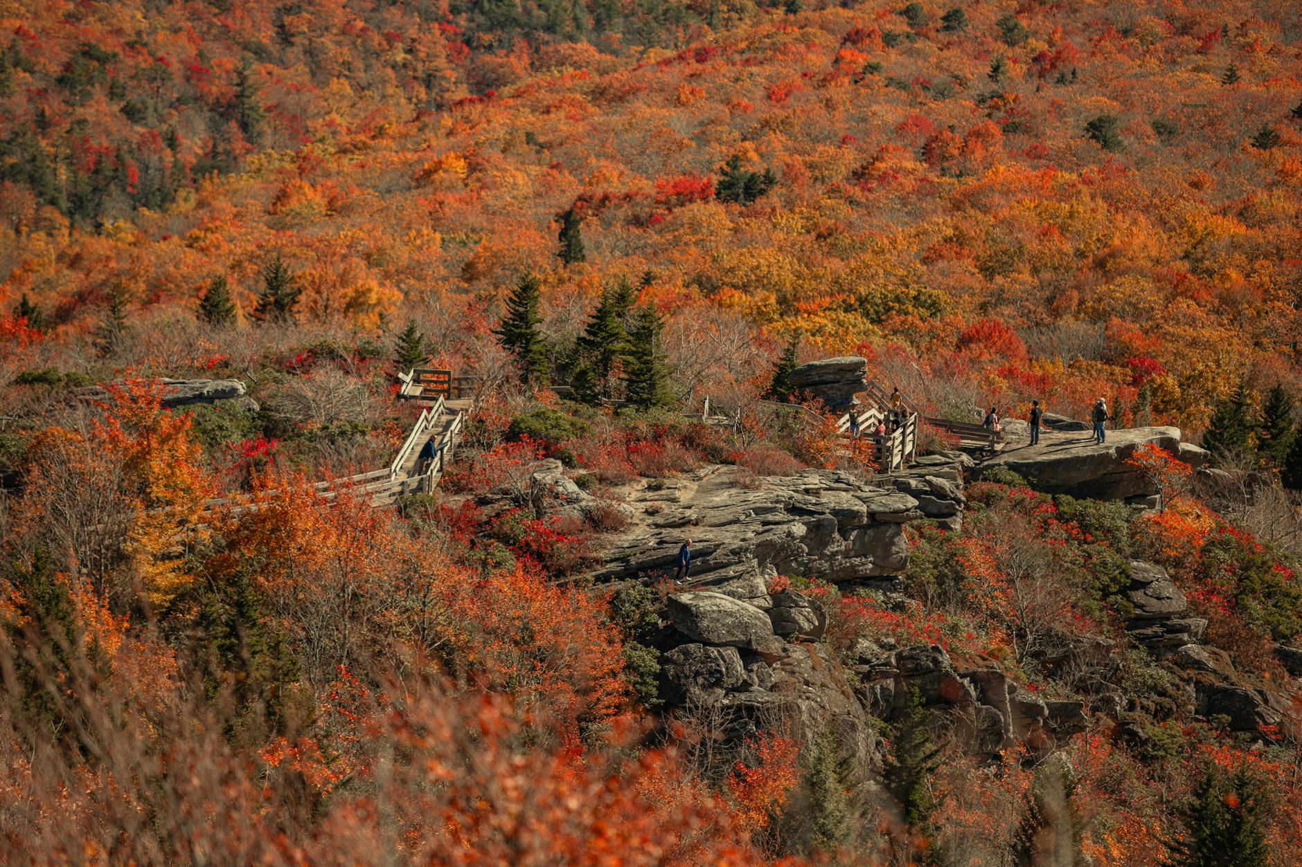
- Rough Ridge (milepost 302.8): a boardwalk about a third of a mile up the trail puts you above slopes of blazing red shrubs. One of the first places to turn every year.
- Linn Cove Viaduct (milepost 304.4): the curving bridge that hugs the side of Grandfather Mountain. Drive it, then walk the trail underneath for a closer look at how it was built.
- Beacon Heights (milepost 305.2): a short, easy climb to bare rocks and a picnic-worthy view.
Around Asheville: the mile-high stretch
South of Asheville, the Parkway climbs above 5,000 feet and stays there. This is where you’ll find the grassy balds, the highest point on the road and the biggest crowds. Worth it. Just go early.
Craggy Gardens (around milepost 364)
Northeast of town, wind-twisted trees and heath balds give Craggy a wild, almost alpine feel. The short climb to Craggy Pinnacle ends in a full-circle view of ridges fading blue into the distance.
Mount Pisgah and Looking Glass Rock (mileposts 407.6 to 417)
The Pisgah Inn sits around 5,000 feet up, and in October everyone wants a window table. Just down the road, Looking Glass Rock Overlook frames a huge granite dome rising straight out of the forest.
Graveyard Fields (milepost 418.8)
Usually the earliest and fiercest color on the Parkway: a high valley of blueberry bushes and shrubs that goes crimson. A short trail leads to a waterfall, and a longer loop takes in two.
Black Balsam Knob (milepost 420.2)
Open, treeless balds and views in every direction. It’s the local favorite for sunrise and a picnic, so it’s packed on weekends. Go midweek or at first light.
Devil’s Courthouse and Richland Balsam (mileposts 422.4 and 431.4)
Devil’s Courthouse is a short, steep climb to a rocky summit with a huge view. A few miles on, Richland Balsam marks the highest point on the entire Parkway at 6,053 feet. The sign makes a fun photo, though the trees up here are mostly dark green spruce and fir, so the color is below you.
Don’t fancy driving the curves yourself? You can join a small-group Blue Ridge Parkway tour from Asheville and spend the whole ride looking out the window.
3 scenic drives on the Blue Ridge Parkway in fall
Trying to see all 469 miles in one trip is how people end up staring at the dashboard instead of the mountains. Pick one of these and do it properly.
The High Country morning (mileposts 294 to 306)
Start in Blowing Rock, join the Parkway at Moses Cone Memorial Park and roll south: Price Lake for reflections, Rough Ridge for the boardwalk, then across the Linn Cove Viaduct to Beacon Heights. It’s only about a dozen miles, but it easily fills a morning.
Asheville to the high balds (Asheville to milepost 431)
Head south past Mount Pisgah, Looking Glass Rock, Graveyard Fields, Black Balsam and Devil’s Courthouse, then turn around at Richland Balsam. It’s the most famous fall drive in the region for a reason. Leave by 7am.
Virginia’s Roanoke run (mileposts 120 to 86)
From Roanoke, drive north past Mill Mountain and the Great Valley overlooks to Peaks of Otter for lunch by the lake and a hike up Sharp Top. The lower elevations mean this route often keeps its color later in the season.
Where to stay for leaf season (book early)
October weekends are the busiest time of year in these mountains, and good rooms in the best-placed towns can be gone by late summer. Pick your base by the stretch you want most.
- Asheville: the most choice, great food and craft beer, and quick access to the mile-high section.
- Blowing Rock or Boone: small-town charm right next to Rough Ridge and Grandfather Mountain.
- Roanoke: the easy base for Virginia’s overlooks, usually calmer and cheaper.
- On the Parkway: Peaks of Otter and the Pisgah Inn put you right on the road, and they book up first.
How to beat the fall crowds
Popularity is the Parkway’s only real downside in October. A few habits change the whole day.
- Skip Saturday, do Tuesday. An overlook with a parking wait on the weekend can be nearly empty midweek.
- Skip noon, do sunrise. The light is warmer, the air is clearer and the lots are open.
- Skip the famous stop, do the next one. Most packed overlooks have a quieter pull-off a mile or two down the road with nearly the same view.
- Pack a picnic. Restaurants are few and far between, and lunch on a stone wall above the valley beats any dining room.
Questions travelers ask
When is peak fall color on the Blue Ridge Parkway?
For most overlooks, mid-October. The highest sections start turning in late September and peak in early October, while lower stretches peak from late October into early November. Exact timing shifts every year with the weather.
Do you have to pay to drive the Blue Ridge Parkway?
No, there’s no entrance fee. Skyline Drive, which continues north from Rockfish Gap through Shenandoah National Park, does charge one, so check the park’s official site for current prices if you’re linking the two.
How long does it take to drive the whole Blue Ridge Parkway?
Pure driving time for all 469 miles is around 10 to 12 hours at the 45 mph limit. With overlooks, hikes and meals, four or five days is comfortable, and a week lets you slow right down.
Which part of the Blue Ridge Parkway is best in fall?
For drama, the North Carolina high country and the mile-high stretch south of Asheville. For fewer people and color that lasts later, Virginia between Roanoke and Peaks of Otter.
Is the Blue Ridge Parkway open in October?
Generally yes, and it’s the busiest month of the year. Sections can still close for repairs or storm damage, so check the NPS road status page before you set off.
One last trick: when you find an overlook you love, come back at golden hour. The ridges you saw at noon turn copper and pink as the sun drops, and the layers of blue fade out one by one. That’s the view you’ll still be describing to friends months later.
Some links in this post are affiliate links. If you book through them, we may earn a small commission at no extra cost to you.
Cover photo by Esteban Carriazo on Pexels